Last Updated on April 22, 2024 by Audrey Scott
15 Months, 16 countries, and 1000s of photos taken on the road – from boats, trains and buses, and on horseback – all of them geotagged and many displayed with GoogleMaps. How do we do it all?
We’re going to tell you in a three-part series – starting now.
We are frequently queried about our photography and the topic of geotagging. The conversation often begins with “What's that device with the blinking light hanging from your camera bag?” The questions continue:
- What is geotagging?
- Why do you geotag your photos?
- How do you geotag your photos?
- How did you get those maps at the bottom of your photo pages to work like that?
We thought a case study on geotagging would be useful for fellow photographers, travelers and technology geeks alike. We’ll publish it in three segments:
- Part 1 (this article) is intended to explain what geotagging is, why you might consider doing it, and which GPS device we use, the Sony GPS-CS1 (Sony GPS-CS1KA). This section is for readers new to the concept of geotagging.
- Part 2 addresses the technical nuts and bolts of taking geolocation data from the Sony GPS-CS1 (Sony GPS-CS1KA) and embedding it into the EXIF data of a photo. We will discuss the hardware and all the various software (Sony GPS Image Tracker, GPSBabel, and GPSPhotoLinker) that we use to efficiently geotag large groups of photos.
- Part 3 covers how to upload your geotagged photos using PictureSync and what you can do with a geotagged photo, including using Google Maps to interactively display where the photo was taken.
A note on naming conventions: We actually use an earlier model of Sony's GPS device, the Sony GPS-CS1. To remain current, we will refer to the device as Sony GPS-CS1KA, the updated (yet functionally and technically similar) model.
What do you mean when you say a photo is “geotagged”?
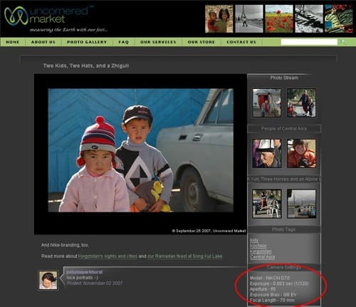
A digital photo is geotagged when location data (latitude and longitude coordinates) are added to the digital file alongside the photo’s existing EXIF data. EXIF is the data in a digital photo file that describes things like the kind of digital camera used to take the photo, the date and time when the photo was taken and the conditions under which the photo was taken (including shutter speed, aperture, etc.). You can find a sample of EXIF data on the right-hand side of one our individual photo pages, under the “Photo Tags” section.
The basic steps of geotagging photos:
- Collect digital location data (latitude/longitude/time coordinates) using a GPS device.
- Based on time stamps, match your photos with the location data logged by your GPS device.
- Embed the matching location data in the EXIF data of your photos.
Why Do We Geotag Our Photos?
As a matter of practicality, we’d like to know where each of our photos was taken.
“Why not jot this down on a piece of paper somewhere?” you might ask.
A valid question perhaps, but considering that over the course of this journey we are using two cameras and taking 1000s of photographs across dozens of locations, this is not a practical option. While we do take notes, we sometimes miss the name of a village or mountain. In the context of extended travel, the process of manually associating accurate location data with each photo becomes a colossal nightmare.
Geotagging our photos is a critical step in accurately documenting our journey. If we use a GPS device and some freely available software, we can batch process and associate our photos with detailed location data (within about 50 meters).
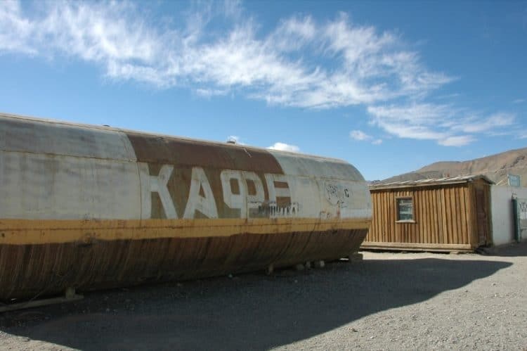
We also use our photos to help us tell a story about our experiences. However, we’ve traveled to some places that are unfamiliar to many (even some geography majors). That's where geotagged photos come in. The answer to the question “Where is Kochkor, Kyrgyzstan?” becomes an experience rather than a one-dimensional text description.
If you leverage GPS technology and online mapping technology like Google or Yahoo Maps, your viewers and readers can interactively answer questions like “Where did you take that photo?” for themselves. When a photo is superimposed on a Google Map, viewers can see both topographical (desert, mountain range, etc.) data and geographical (location) data simultaneously.
Moreover, it’s just plain cool…or, at least we think it is.
The Sony GPS-CS1KA
 We wanted something small, light, easy-to-use and affordable, so we opted to purchase the Sony GPS-CS1. It's easily attached to a camera bag strap or belt loop by way of its plastic carabiner. The device takes one AA battery. It is so small and light that we forget we have it most of the time.
To get started, turn on the Sony GPS-CS1KA by pressing the button and holding it until a green light starts blinking. Provided that you have a clear line of sight to the sky (even through a car window), it takes between five and ten minutes to locate a satellite and begin logging coordinates. When the device searches for a satellite, it blinks several times in succession. Once the device finds a signal, coordinates will be logged every 15 seconds thereafter and the indicator will blink steadily once every few seconds.
This device has no interface; it's simply a receiver that logs location data echoed back to it from GPS satellites orbiting the earth. If this explanation causes you pain, think of it as a conversation between GPS device and a GPS satellite:
GPS Device: “Hey, where am I?”
GPS Satellite: “Based on where you are sending your signal from, I'd say you are at these latitude and longitude coordinates”
GPS Device: “Cool. Let me write that down on my little memory chip.”
When the light turns red on the device, it's time for a new battery. If you're outside for most of the day, meaning that the GPS spends its time continually logging coordinates rather than searching for a satellite connection, we have found that a fully charged battery usually lasts eight hours or more. If you spend much of your time out of range of a signal, then the device will consume more power trying to find one.

We've occasionally encountered problems getting a satellite signal outside due to heavy smog or buildings blocking its line of sight (Beijing, China comes to mind). If you anticipate spending a lot of time in a car or boat, make sure that the device is positioned in a window (the satellite signal can be received through glass) or on the side of a boat (above the water level for obvious reasons). If you don't normally carry a camera bag, attach the GPS device to your belt loop.
The storage capacity of the Sony GPS-CS1KA is 31 MB, or approximately 15 full days worth of logs. If you find yourself on an extended journey, you should either download the log files to your laptop or find an internet cafe where you can copy the files from the device to a CD or – more ideally – to a USB thumb drive.
So, if you ever happen to meet us on the road and notice a blinking green light attached to us, don't be concerned. We're not bugged or being tracked (at least, not that we're aware of); it's just our GPS device doing its job.
Next up in Part 2, we cover the software that we use in conjunction with the Sony GPS-CS1KA to geotag large groups of photos: Sony GPS Image Tracker, GPSBabel, and GPSPhotoLinker.
Nice reading about geotagging. Nice that you are able to do it…Thanks for educating the masses…
Read about you both in the Scranton Times and was highly intrigued. I am from Scranton (or more specifically living in Moosic)…I thought I had “travelled the world” but I have seen next to nothing. My list includes Argentina, Brazil, China, Taiwan, and Iran.
I will try to read more of your blogs, and visit as much as I can. Thanks again for sharing your world and THE WORLD with the rest of us.
–Jahan
Jahan: You are welcome. Thank you for your comment.
We’re glad you enjoyed the information about geotagging. We’ll publish two more segments on it in the next few days. We hoped to provide enough information in this series so that someone could understand geotagging from start to finish (in the current technology environment, at least).
The countries you listed are interesting. So, from we are sitting, they are aren’t “next to nothing.” One way to think about the list is “a good start.” The world is a big place.
Thanks so much for the article on Geotaging photos. I’ll look forward to the rest in the series. I’m working on building up my ‘flashpacker’ wish list before I get back out on a regular travel schedule and I’ve been wondering what the point of Geotaging was. I never thought about the fact that digital photography makes the 1000s of pictures now a norm and so remembering where you took them all (my previous practice) is no longer a practicality. Thanks so much!
-Kango Suz
http://www.startgo.com
Kango Suz: Glad you enjoyed this article and hope you make it through the next couple of pieces in the series! Thanks also for commenting and introducing us to your site in the process.
You are so right that the convenience of being able to know the location of thousands of photos taken over numerous countreis makes the geotagging process so worth it. The last long travel we did was in 2000 (4 months) back in the day before we had digital cameras. While we took notes on our trip, we still had many pictures come up as “some cute village in southwestern France” or “some mountain village in Austria” as we scanned in all our negatives last summer and attempted to label them.
We still take copious notes on this trip to help us with our posts and photo captions, but at least the chore of remembering exactly where every photo was taken is now done automatically for us.
Hi over there (wherever “there” is by now :), Dan and Audrey. You’re encouraging me to get busy on geotagging before (with luck…) I head for the boonies myself this Spring.
My camera is a Nikon D200; iI think the Sony GPS gadget isn’t compatible. A quick Web search found lots of information for my camera — which, like most Nikon cameras, has verrry expensive accessories. I thought I’d mention one page from a do-it-yourselfer who managed to get around Nikon’s high price ($150 for a cable!?) — and to give other info about hooking a more-generic GPS device to a camera. His page is http://www.core5.net/projects/d200GPS/ . (I haven’t tried his method yet, by the way.)
Happy trails…
Jerry
Hi Jerry!
You are right in that the Sony GPS-CS1KA won’t connect directly to your Nikon D200 to embed the latitude and longitude data directly into the EXIF data of the photos. However, if you want to avoid expensive cables, you can still use the Sony GPS device in the way described in this case study – attach it to your camera bag or belt loop and do the batch geotagging on your laptop based on the time stamp on the photo and in the GPS logs. Whichever way you choose to do it, it’s pretty cool to see the Google Maps and topographical information of everywhere.
We leave KL tomorrow for Melaka and then we have a few days in Singapore before exploring India. Should be a pretty wild next couple of months.
Have fun planning your next adventure!
Audrey
Thanks, Audrey. After having my camera stolen once (in Panama City), I’ve gotten more cautious about carrying a laptop… and sometimes I just fill up my camera’s memory cards, review the photos tto delete bad ones, then transfer the photos to two sets of CD/DVDs at a cybercafe, snail-mail one set to home, and wait until I’m home to work on the photos. (If I ever get the chance again to travel as much as you and Dan are, though, I wouldn’t want to wait so long to sort my photos, for sure!) It’s good to know that there’s a batch-processing option like this… maybe I could get a cheap laptop to handle that part and not worry too much about losing it?
i’ve heard so many great stories about India… can’t wait to see your stories and photos!!
Jerry
You’re right, traveling with a laptop has its advantages and disadvantages. For us, it’s a necessity, but for shorter trips that’s a harder call.
If the trip is relatively short (i.e., less than 15 days), you could just take the GPS logs off the device after the trip. For longer trips without a laptop, you could hop into an internet cafe, connect the GPS device to the computer’s USB port and copy the files to a USB flash drive or CD/DVD (if you’re backing up photos anyway).
We just had an interesting experience this evening at the Hindu temple in Melaka, Malaysia. I have a feeling it’s just a small taste of what’s to come once we’re in India proper!
Have fun preparing for your next trip!
Audrey
Great article! I like using GPicSync myself – I think the interface is better than the Sony GPS software.
Here is a product absolutely worth recommending. It is called Easytagger (www. e-geotag.com). For first, it can direct input GPS information into photos taken by certain Nikon cameras and no need for matching. Second, it has a 2 G TF card to store at least 2 years traits. Third it uses barometric altitude, you can get a very accurate height figures.
It’s a great device, I like the Easytag Gps Unit, it’s really perfect partner when I hiking outdoor.
The GPS logger is just a receiver. It doesn’t talk to satelites, otherwise it would need stronger batteries. The satelites send time information. The receiver gets the time from several satelites. When the receiver is closer to one satelite, the other one is gonna look late, and that’s how the receiver knows where you are. It’s by knowing how fast the information takes to come from each satelite. That’s why the more satelites, the better. That’s it. Each satelite send the correct time: they just inform what time it is. The GPS receiver just listens.
@Tulio: Thanks for the explanation. We find ourselves having to describe the difference between the logger (receiver) we carry and what everyone associates with a GPS device — namely a transmitter/receiver that features maps and current position.
If the receiver just listen, how does it find the satellite? The logger also use gps chipset to communicate with the satellite and when it finds 3 or 4 satellites together, it will get a precise location data. And it will record this data at the time interval set up before. And some direct geotagging gps devices like mentioned above, EasyTagger GPS, do the same thing, just they got the cable to communicate with the camera.